August 26, 2020

Soil Scientists Study Blue Carbon

by S-FX.com

marsh

By Robert Tunstead, Natural Resources Conservation Service (NRCS)

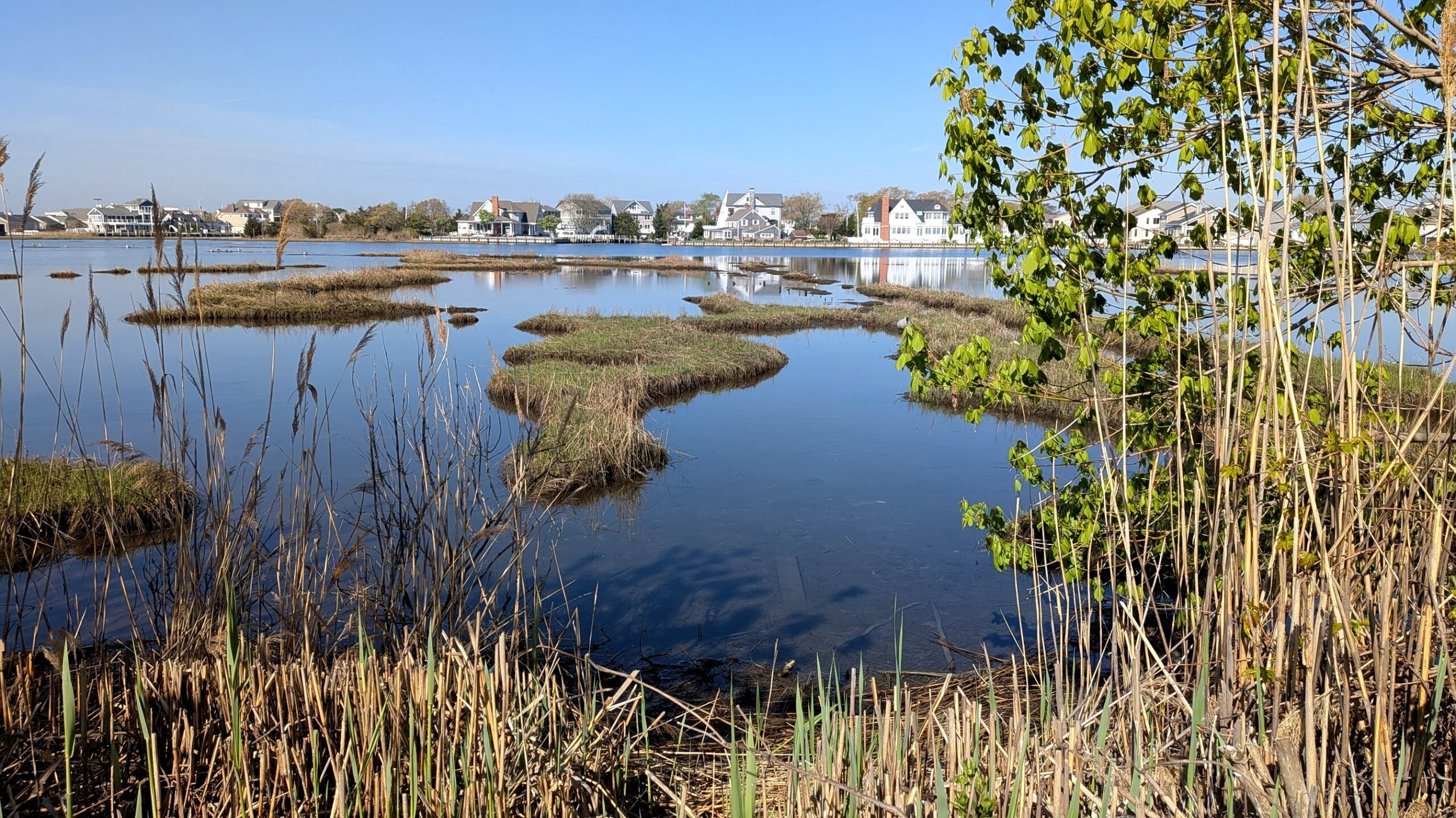
“Blue carbon” is the term used to describe the carbon captured by the world’s oceans and coastal ecosystems. Salt marshes take up large amounts of carbon dioxide during the summer growing season and store it in the form of organic matter.  This process of capturing and storing, or sequestering, carbon occurs at a much faster rate in salt marshes and other highly productive coastal ecosystems than in upland forests. Left undisturbed, salt marshes provide an important natural way of reducing the impact of greenhouse gases on our planet.  

How much blue carbon is captured and stored in coastal soils?  The National Coastal Blue Carbon Assessment project is an initiative started by the Natural Resources Conservation Service (NRCS) Soil and Plant Science Division’s Coastal Zone Soil Survey Focus Team to help answer this question by measuring blue carbon throughout the country. Here in New Jersey, the NRCS’s Hammonton Soil Survey Office is partnering with the Barnegat Bay Partnership (BBP) to provide soils data as part of an EPA Regional Applied Research Effort (RARE) grant project. The main goal of the project is to study coastal wetland marsh degradation within the Barnegat Bay estuary. However, along with providing typical soil sampling for the project, the Hammonton Soil Survey Office is also collecting soil samples for blue carbon analysis. 

Coastal Blue Carbon Vibracore Photo By Rob Tunstead 2 Rotated 1
NRCS Intern Jeanette Myers and Soil Scientist David Steinmann retrieve a vibracore from the marsh soil using an aluminum ladder and chain hoist. Photo by Rob Tunstead.

After a delay due to COVID-19 stay-at-home orders, field sampling for the project began in June, with researchers using proper social distancing and proper PPE equipment. At the 25 sampling sites, the BBP is conducting habitat and biological studies, while the NRCS is collecting soil samples. The NRCS retrieves three vibracores at each site location. Vibracoring is a sediment sampling methodology used to retrieve a continuous, undisturbed sample of unconsolidated saturated sediments.

Coastal Blue Carbon A Vibracore Soil Profile By Rob Tunstead Rotated 1
One of the vibracore soil samples. Photo by Rob Tunstead.

Two vibracores are examined in the field, then sent to a local lab where they are split open, photographed, described, and sampled by soil scientists from the Hammonton Soil Survey Office. After this initial sampling work, they are sent to the NRCS’s Kellogg Soil Survey Lab for a complete soil analysis. The third vibracore is sent to a separate team at the National Soil Survey Center for “whole core” blue carbon analysis.

Thanks to this joint collaborative effort by the BBP and NRCS, soils data is contributing to two important research projects – the BBP’s study of the degradation of coastal tidal wetlands in the Barnegat Bay estuary and the NRCS’s study of the amount of blue carbon stored within this valuable coastal ecosystem. The results of this project will help inform local partners in their efforts to protect and restore the deteriorating but critical tidal wetlands in our watershed.   
Explore More Insights from Barnegat Bay

Dive deeper into the ongoing efforts to protect and restore our environment with more updates and initiatives that you can take part in. Check out our latest blog posts for valuable tips and insights.

UNKNOWN

There is limited data available to quantify Wetland and Riparian Buffer Preservation, or updated data to quantify Wetland Acreage. The BBP has obtained funding and will begin assessment efforts for both targets, in the next few years.


 Hard Clam abundance has not been updated since 2012. Recovery of the stock will be guided by the Fishery Management Plan for Hard Clams, which is under development with the NJDEP, BBP, and other organizations. Reclam the Bay and other partners have continued to plant clams for restoration purposes. Continued plantings in strategic locations which maximize survival and reproduction is one strategy to pursue in the coming years. This work can use a model developed by Rutgers with BBP funding which identified areas where planted clams could have the greatest dispersal of their larvae and thus potentially maximally contribute to the recovery of the stock.

 Water Withdrawals were over the target in the 2021 report; USGS has not yet completed its latest update, so a definitive determination of status is not available. However, additional NJDEP data show that it is likely that we continue to not meet the target. Per capita water use has gone down, demonstrating the effectiveness of water-saving appliances and practices, but that decrease has been offset by population gains. 


IN PROGRESS

New maps quantifying Submerged Aquatic Vegetation extent were developed, but poor image clarity resulted in a high degree of uncertainty in the total acreage. NJDEP and Rutgers are working to resolve the uncertainty of these maps, and improve the total acreage estimate. Funding has also been obtained for further research and restoration activities. Several groups are developing potential restoration actions.

The USGS has completed the first phase of its study to identify minimum ecological flows in select Barnegat Bay tributaries. USGS scientists compared streamflow statistics between historical and current time periods to better understand trends in watershed flow conditions. This work provides a foundation for developing ecological flow targets in the Barnegat Bay watershed.  Similar to SAV extent, funding (approximately $450K) has been obtained by the BBP to complete the remaining phases necessary for threshold determination.


TARGETS ACHIEVED

No targets can be considered “Achieved” at this time.


NOT ACHIEVING

Several Public Swimming Beaches exceeded their safe swimming standards more frequently than during their baseline time period (2016-2018).

While most beaches are routinely safe for swimming, several problematic areas such as Beachwood, Hancock, Windward, and several lake beaches need track-down studies and restoration to pinpoint and address sources of bacteria.

Acres of Approved Shellfish Waters decreased from the last report. While this decrease was small, it represents a loss of previously approved waters. Similar to public beaches, track-down studies and restoration work are needed to pinpoint and address sources of bacteria.


Soil Scientists Study Blue Carbon

By Robert Tunstead, Natural Resources Conservation Service (NRCS)

“Blue carbon” is the term used to describe the carbon captured by the world’s oceans and coastal ecosystems. Salt marshes take up large amounts of carbon dioxide during the summer growing season and store it in the form of organic matter.  This process of capturing and storing, or sequestering, carbon occurs at a much faster rate in salt marshes and other highly productive coastal ecosystems than in upland forests. Left undisturbed, salt marshes provide an important natural way of reducing the impact of greenhouse gases on our planet.  

How much blue carbon is captured and stored in coastal soils?  The National Coastal Blue Carbon Assessment project is an initiative started by the Natural Resources Conservation Service (NRCS) Soil and Plant Science Division’s Coastal Zone Soil Survey Focus Team to help answer this question by measuring blue carbon throughout the country. Here in New Jersey, the NRCS’s Hammonton Soil Survey Office is partnering with the Barnegat Bay Partnership (BBP) to provide soils data as part of an EPA Regional Applied Research Effort (RARE) grant project. The main goal of the project is to study coastal wetland marsh degradation within the Barnegat Bay estuary. However, along with providing typical soil sampling for the project, the Hammonton Soil Survey Office is also collecting soil samples for blue carbon analysis. 

Coastal Blue Carbon Vibracore Photo By Rob Tunstead 2 Rotated 1
NRCS Intern Jeanette Myers and Soil Scientist David Steinmann retrieve a vibracore from the marsh soil using an aluminum ladder and chain hoist. Photo by Rob Tunstead.

After a delay due to COVID-19 stay-at-home orders, field sampling for the project began in June, with researchers using proper social distancing and proper PPE equipment. At the 25 sampling sites, the BBP is conducting habitat and biological studies, while the NRCS is collecting soil samples. The NRCS retrieves three vibracores at each site location. Vibracoring is a sediment sampling methodology used to retrieve a continuous, undisturbed sample of unconsolidated saturated sediments.

Coastal Blue Carbon A Vibracore Soil Profile By Rob Tunstead Rotated 1
One of the vibracore soil samples. Photo by Rob Tunstead.

Two vibracores are examined in the field, then sent to a local lab where they are split open, photographed, described, and sampled by soil scientists from the Hammonton Soil Survey Office. After this initial sampling work, they are sent to the NRCS’s Kellogg Soil Survey Lab for a complete soil analysis. The third vibracore is sent to a separate team at the National Soil Survey Center for “whole core” blue carbon analysis.

Thanks to this joint collaborative effort by the BBP and NRCS, soils data is contributing to two important research projects – the BBP’s study of the degradation of coastal tidal wetlands in the Barnegat Bay estuary and the NRCS’s study of the amount of blue carbon stored within this valuable coastal ecosystem. The results of this project will help inform local partners in their efforts to protect and restore the deteriorating but critical tidal wetlands in our watershed.   
Contact Soil Scientists Study Blue CarbonContact Soil Scientists Study Blue Carbon
marsh
Photo credit: Rob Tunstead