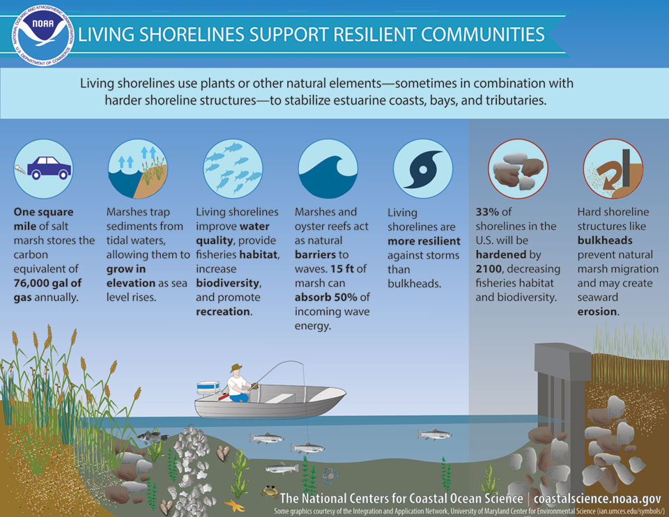
A nature-based, or living, shoreline uses natural materials, alone or in combination with other structures, to stabilize an eroding shoreline. Nature-based shorelines provide a natural alternative to “hard” stabilization methods, such as rip rap or bulkheads, and provide numerous environmental benefits.

The Barnegat Bay Partnership is assisting with the installation and monitoring of nature-based shoreline projects in the Barnegat Bay estuary.
Sedge Island Shoreline Project

In 2019, the Barnegat Bay Partnership assisted the NJ DEP’s Division of Fish and Wildlife and Marine Fisheries Administration with the installation of a living shoreline at the Sedge Island Natural Resource Education Center. The project consists of “soft,” nature-based coconut fiber mats and logs designed and installed to mitigate shoreline erosion under the caretaker’s house at the Center.
After assessing damage from several large storms in the fall and winter of 2019-2020, the BBP began working with the NJDEP and Partnership for the Delaware Estuary to determine the best strategies for ensuring the stability of the materials used in the project. BBP wetlands scientists conducted elevation and position monitoring at the site in 2020 and will continue to track changes over the next several years. The monitoring data will not only inform management of this project but also help improve designs for future shoreline projects.
Little Egg Harbor Shoreline Projects
In 2020, two shoreline stabilization projects were installed in Little Egg Harbor, one at Iowa Court and one at Green Street, with funding provided by the NJ Corporate Wetlands Restoration Partnership.

The BBP designed a monitoring plan that borrows metrics from the Mid-Atlantic Wetlands Assessment (MACWA) framework to track changes to these two projects over time. BBP scientists completed the first round of assessments in 2020. With additional funding provided by the Township of Little Egg Harbor, the BBP will continue to monitor the projects for the next several years. The BBP also teamed up with the NJDEP Office of Information Technology to use drone technologies to visualize and quantify project progression. Using high resolution imagery, researchers can track specific movements in vegetation communities, shoreline position, and project structures.
Watch this video about the two projects, also available on our YouTube channel.

