What is Seining?
Seining is a method used by scientists and environmental professionals to collect fish, invertebrates, and other organisms from shallow waters. It involves pulling a large mesh net through the water, typically toward the shore or between two points. This seine net is designed to capture animals living throughout the entire water column, from the surface to the bottom. A typical seine net has floats along the top (called a float line) that keep it buoyant, and weights along the bottom (called a lead line) to ensure it stays in contact with the seabed.

Seine nets can vary in size and design depending on the environment and the goals of the sampling effort; they may differ in length, mesh size, net shape, and even whether they are pulled by people or by boat. At the Barnegat Bay Partnership (BBP), we use a 15-meter (50-foot) seine net with 6-millimeter mesh and a 1.8-meter (6-foot) deep bag to collect fish and other organisms from the bay. Unlike some larger operations like New Jersey Department of Environmental Protection (NJDEP) or National Oceanic and Atmospheric Administration (NOAA) that use boats to deploy and retrieve nets, our seining is done entirely by hand, with two people walking the net through the water. Because we sample in shallow areas usually no deeper than 1 meter (about 3.5 feet), this method is both effective and practical for projects like our Long-term Juvenile Fish Monitoring Survey.
BBP’s Long-term Juvenile Fish Monitoring Survey Background

The Barnegat Bay Partnership’s Long-term Juvenile Fish Monitoring Survey began in 2011 as part of a preliminary assessment for a barrier net project that evaluated the effectiveness of jellyfish exclusion nets along Ocean County’s shorelines (Vasslides et al., 2018). Initially, sampling was limited to two locations: Windward Beach Park in Brick Township and the Brooklyn Avenue Beach in Lavallette Borough. When the barrier net study concluded in 2013, BBP transitioned the effort into a broader, long-term monitoring initiative. By that time, the program had expanded to include seven sites across northern and central Barnegat Bay. In 2018, the survey grew to encompass 18 sites, stretching from Brick Township to Mystic Island. Subsequent years saw minor reductions due to the completion of site-specific monitoring efforts in Mystic Island, Tuckerton, and Berkeley Island, bringing the total number of active sites to 15 as of 2025. To streamline logistics and improve sampling efficiency, BBP categorizes these sites into three regional clusters.
The “northern” cluster, centered around Toms River, includes Windward Beach, two sites at Cattus Island, Lavallette Beach, and Shelter Cove Beach. The “central” cluster, near and within Ocean Gate, includes Brown’s Woods, Ocean Gate Beach, Allen Road, Berkeley Island Beach, and Brennan Concourse. Lastly, the “southern” cluster, covering the Tuckerton and Mystic Island region, comprises Barnegat Township Beach, Parkertown Dock Bay Beach, Great Bay Boulevard, Iowa Cove, and Green Street. Each site is sampled on a biweekly basis from the middle of May to the end of October with data entry and report writing finishing out the year as part of BBP’s ongoing commitment to tracking juvenile fish populations and estuarine health in the Barnegat Bay estuary.

Seining: A Day in the Life

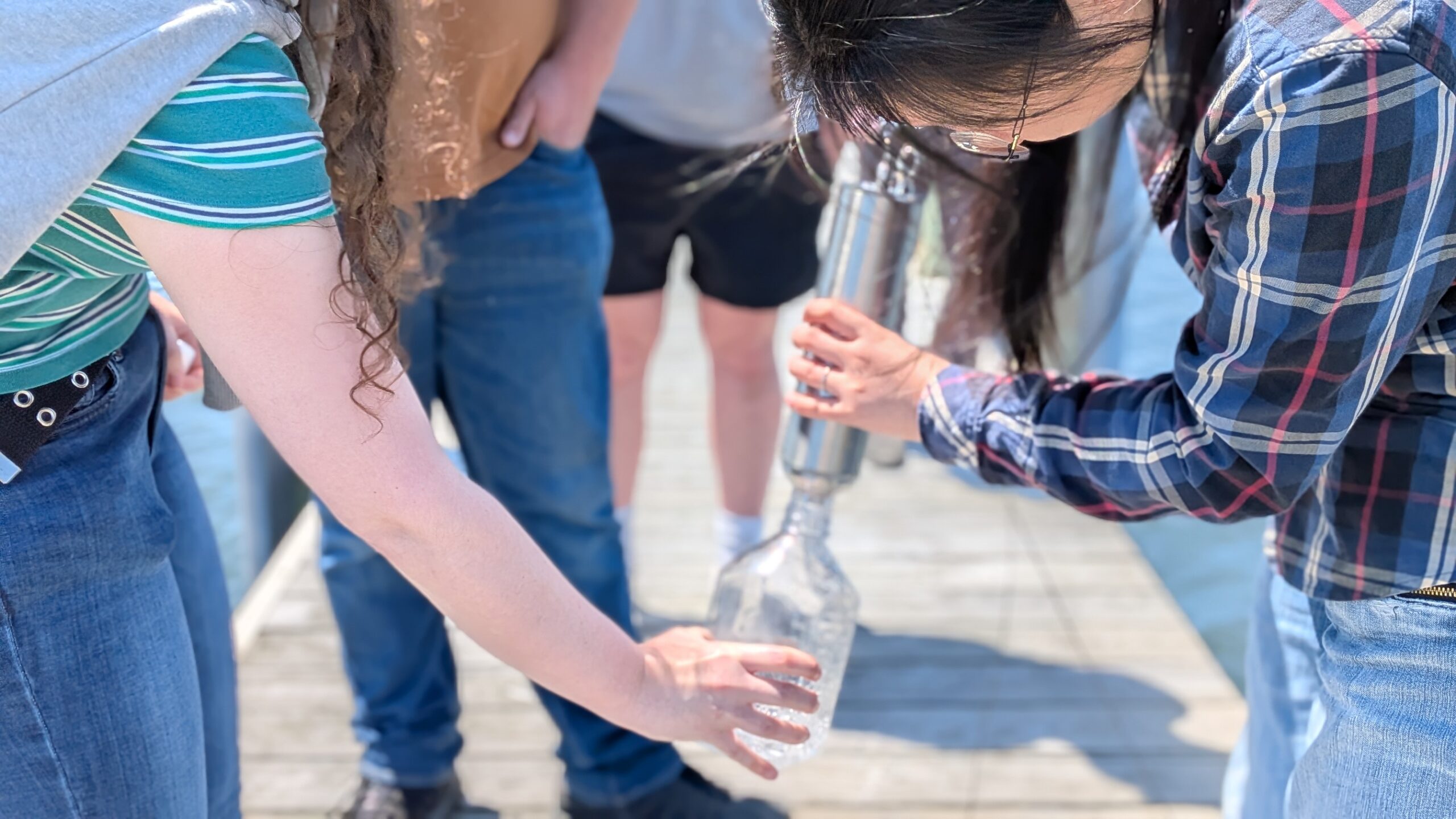
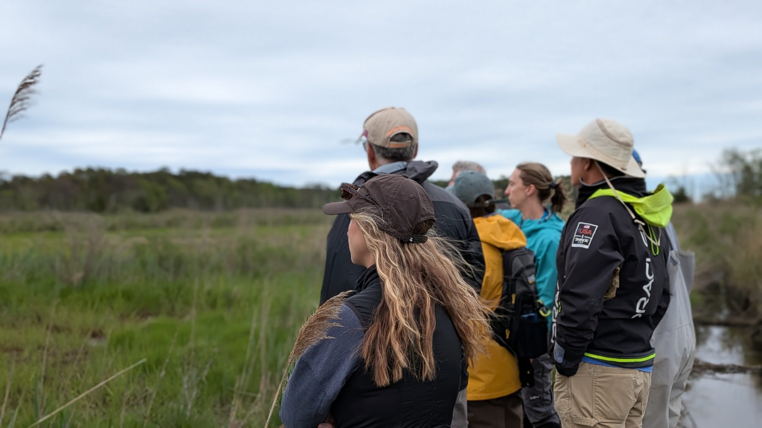
Spending a day seining with the Barnegat Bay Partnership (BBP) is a unique experience, especially when the weather is on your side. Warm, sunny days on the bay can feel like a privilege, though the work continues rain or shine. High winds, heat, or sudden cold fronts can certainly make the job more demanding, but even on those days, it beats being stuck inside an office. Our seining days usually begin at the BBP water quality lab. Full-time staff and part-time technicians gather early to prep and calibrate our YSI ProDSS multiparameter instrument, which measures key water quality indicators like dissolved oxygen, temperature, salinity (conductivity), and pH. Once that’s ready, we load up the field gear: waders, our 50-foot seine net, measuring boards, Secchi disk, sample bins, and anything else we’ll need out in the field. Then we’re off to one of our three geographic clusters: northern, central, or southern Barnegat Bay, each containing five different monitoring sites. Upon arrival at the first site, we unload the gear, suit up in waders, and start by recording wind speed and direction.
Next comes the first tow: we carefully walk the seine net out about 50 feet into the water, trying to disturb the habitat as little as possible, then pull it back in parallel to the shoreline. Once the net is hauled in, we sort and identify the catch. We measure the first 20 individuals of each species to establish a representative subsample, then count the remaining individuals if any. After recording the total haul time, we perform a second tow at an undisturbed location which is usually 50 feet to the upstream side of the first, and then repeat the same process. Before wrapping up at the site, we take water quality readings with the YSI, measure water depth, and record Secchi disk visibility to assess turbidity. After the site is complete, we pack up and move on to the next one in the cluster.
Around halfway through the day, we stop and check our YSI to see if its readings are still within range of calibration, often called a “7-check” as it relates to checking a pH reading of 7. Now, once all five sites are sampled, the day winds down with rinsing and inspecting our gear for any damage before returning to the office. It’s a full day of fieldwork, physically active, data-rich, and always changing with the tides, weather, and catch. For those who love marine life, field science, and the outdoors, it’s one of the best ways to spend a workday!