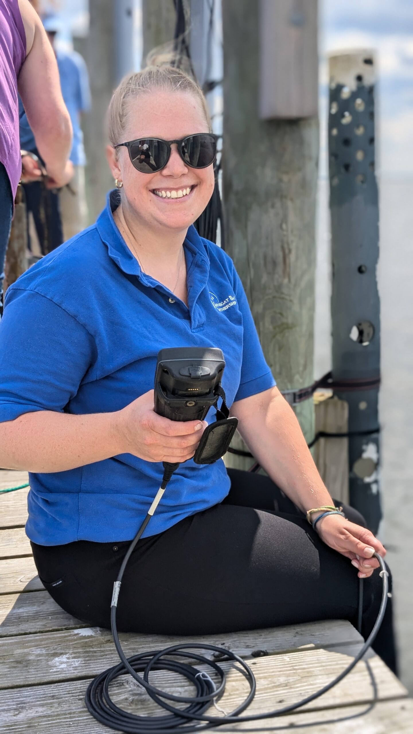
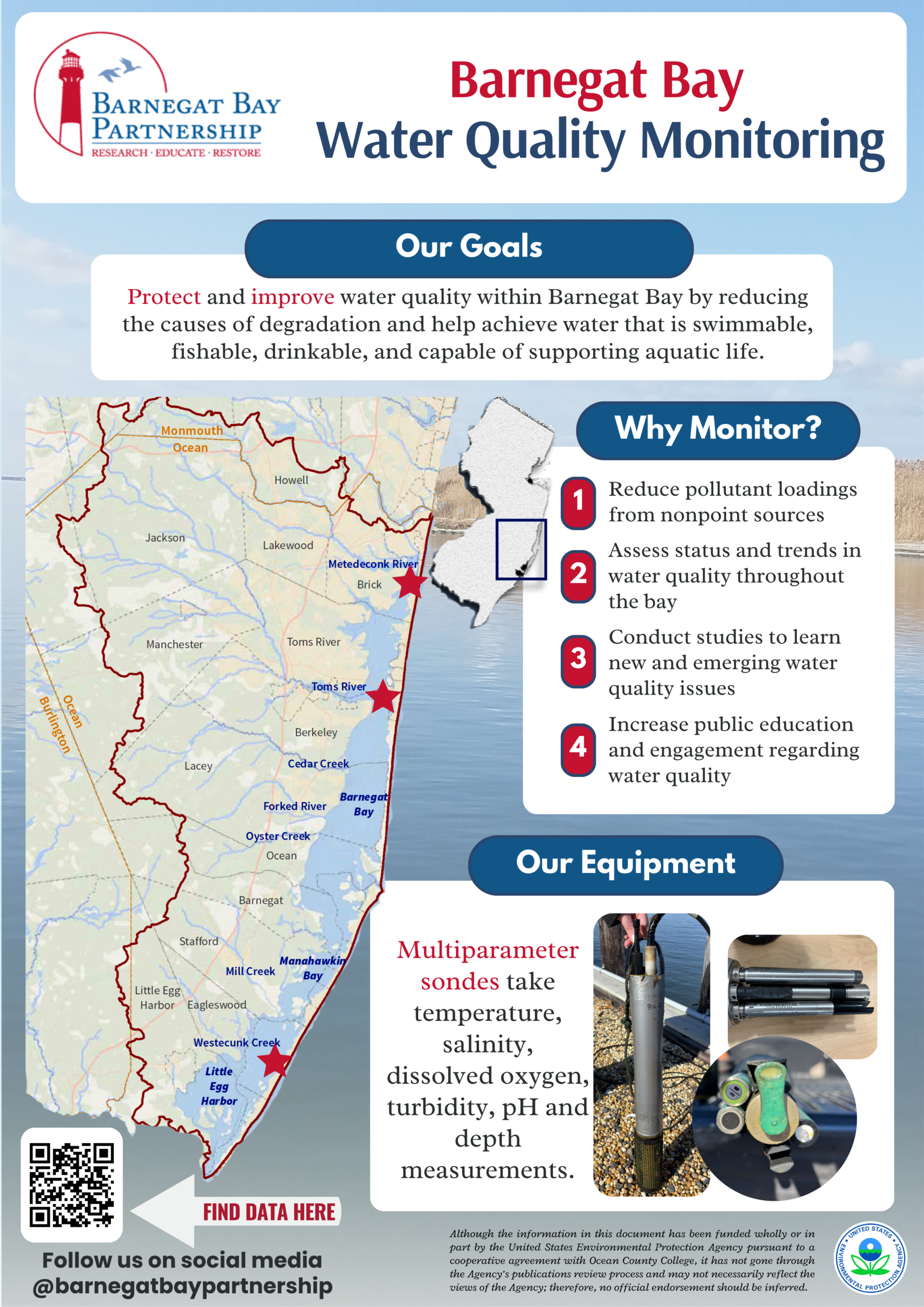
BBP Continuous Water Quality Monitoring Network

Coastal water quality can affect human health, the health and sustainability of fish and wildlife populations, and many commercial and recreational activities within the Barnegat Bay, including fishing, shellfishing, swimming and ecotourism. As human populations continue to increase in coastal areas, coastal waters are increasingly impacted by various stressors, potentially contributing to decreased water quality, including algal blooms, low dissolved oxygen, and a cascade of adverse environmental and economic problems.

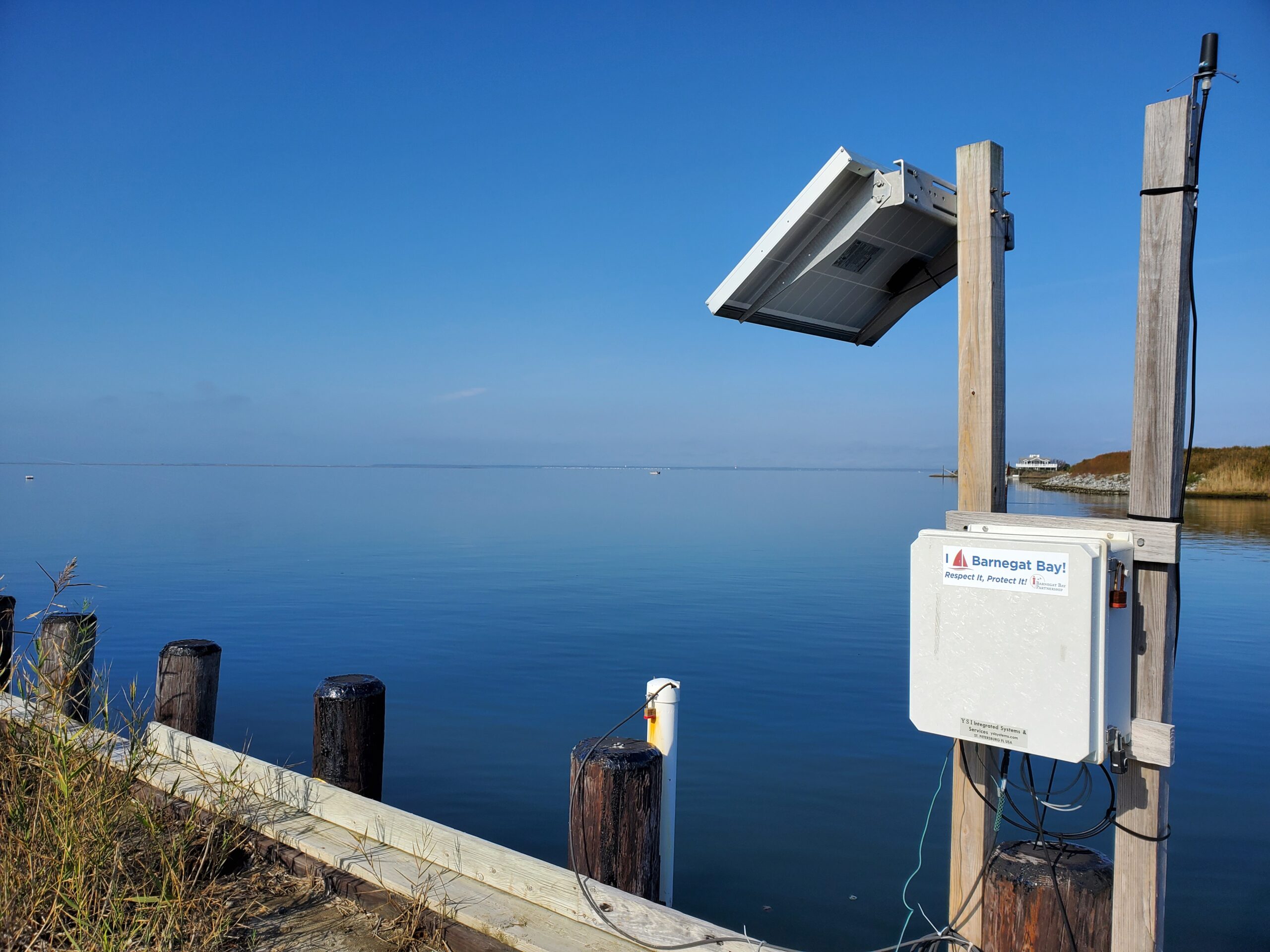
The Barnegat Bay Partnership has established a network of continuous water quality monitoring stations throughout the bay to better understand the temperature, salinity, oxygen, pH, turbidity, and water depth changes that may result from climatological stressors. 

This information is trasmitted in near-real time to the NJDEP’s continuous water quality monitoring website which is available for public download. 

Explore the Real-Time Water Quality Monitoring Data PortalWhy water quality mattersWhy collect water quality

The Water Quality Monitoring Data Portal

In order to ensure these parameters remain consistently ideal for life in the Barnegat Bay, the BBP has been collecting continuous data, streaming right from the bay, since 2017. Federal funding from the Infrastructure Investment and Jobs Act have provided the BBP the opportunity to update equipment so that data can be streamed in real time (15-minute intervals) to the NJ Department of Environmental Protection (NJDEP). This system not only provides valuable insights for researchers and managers but also helps identify emerging problems before they cause lasting ecological damage. 

BBP’s continuous water quality monitoring program aims to give stakeholders including residents, educators, water quality managers, and scientists timely access to reliable measurements of coastal water quality. The three long-term stations in Beach Haven, Seaside Park, and Mantoloking transmit real-time data to NJDEP and the Rutgers University Continuous Data Monitoring Program website, where it is available for download. The data are also used in the NJDEP’s Water Quality Assessments and Integrated Reports. Assessments are conducted statewide every two years under Sections 303(d) and 305(b) of the federal Clean Water Act to determine whether water quality conditions have changed over time.
Curious about what’s happening in the waters near you? The data portal makes it easy to dive in and explore. Whether you want to check conditions before heading out to fish, spark curiosity in your classroom, or simply learn more about your local ecosystem, the information is readily available. By exploring the portal and staying informed, you become part of the effort to protect this estuary. The Barnegat Bay Partnership is committed to safeguarding the bay for wildlife and for the people who depend on it. We invite you to learn, share, and get involved because when the bay thrives, so do our communities. 


Explore the Real-Time Water Quality Monitoring Data Portal

Quick Portal Tutorial

UNKNOWN

There is limited data available to quantify Wetland and Riparian Buffer Preservation, or updated data to quantify Wetland Acreage. The BBP has obtained funding and will begin assessment efforts for both targets, in the next few years.


 Hard Clam abundance has not been updated since 2012. Recovery of the stock will be guided by the Fishery Management Plan for Hard Clams, which is under development with the NJDEP, BBP, and other organizations. Reclam the Bay and other partners have continued to plant clams for restoration purposes. Continued plantings in strategic locations which maximize survival and reproduction is one strategy to pursue in the coming years. This work can use a model developed by Rutgers with BBP funding which identified areas where planted clams could have the greatest dispersal of their larvae and thus potentially maximally contribute to the recovery of the stock.

 Water Withdrawals were over the target in the 2021 report; USGS has not yet completed its latest update, so a definitive determination of status is not available. However, additional NJDEP data show that it is likely that we continue to not meet the target. Per capita water use has gone down, demonstrating the effectiveness of water-saving appliances and practices, but that decrease has been offset by population gains. 


IN PROGRESS

New maps quantifying Submerged Aquatic Vegetation extent were developed, but poor image clarity resulted in a high degree of uncertainty in the total acreage. NJDEP and Rutgers are working to resolve the uncertainty of these maps, and improve the total acreage estimate. Funding has also been obtained for further research and restoration activities. Several groups are developing potential restoration actions.

The USGS has completed the first phase of its study to identify minimum ecological flows in select Barnegat Bay tributaries. USGS scientists compared streamflow statistics between historical and current time periods to better understand trends in watershed flow conditions. This work provides a foundation for developing ecological flow targets in the Barnegat Bay watershed.  Similar to SAV extent, funding (approximately $450K) has been obtained by the BBP to complete the remaining phases necessary for threshold determination.


TARGETS ACHIEVED

No targets can be considered “Achieved” at this time.


NOT ACHIEVING

Several Public Swimming Beaches exceeded their safe swimming standards more frequently than during their baseline time period (2016-2018).

While most beaches are routinely safe for swimming, several problematic areas such as Beachwood, Hancock, Windward, and several lake beaches need track-down studies and restoration to pinpoint and address sources of bacteria.

Acres of Approved Shellfish Waters decreased from the last report. While this decrease was small, it represents a loss of previously approved waters. Similar to public beaches, track-down studies and restoration work are needed to pinpoint and address sources of bacteria.